Final Verification Without the Finger-Pointing
Close Out With Confidence Using Drone-Captured Terrain and As-Built Data
When the last home is framed and landscaping is going in, the risk isn’t over — it’s just shifting. Poor drainage, elevation discrepancies, or incomplete utility backfill can lead to costly post-build warranty claims. That’s where our drone-based LiDAR and photogrammetry solutions deliver a significant advantage, quickly.
With high-accuracy aerial data, you can verify that each lot and the entire subdivision meet design specifications before turnover.
Schedule a demo to see how our platform compares to the competition. We can fly our drone at your location, upload your designs, and show you what our platform can do for you in less than 24 hours. In one demo, we found a $18,000 error in the first 5 minutes – what will we see on your project site?
Catch the Issues Before the New Homeowner Does
Our platform makes it easy to:
- Compare the as-built terrain to the grading design plans
- Validate final lot elevations and swales
- Confirm drainage slopes and flow direction
- Detect unapproved grading changes or pad shifts
- Verify driveway, sidewalk, and utility as-built conditions
With every drone flight, we capture a high-resolution 3D model of your subdivision — including homes, roads, pads, and adjacent lots — allowing you to quantify exactly what was built and where.

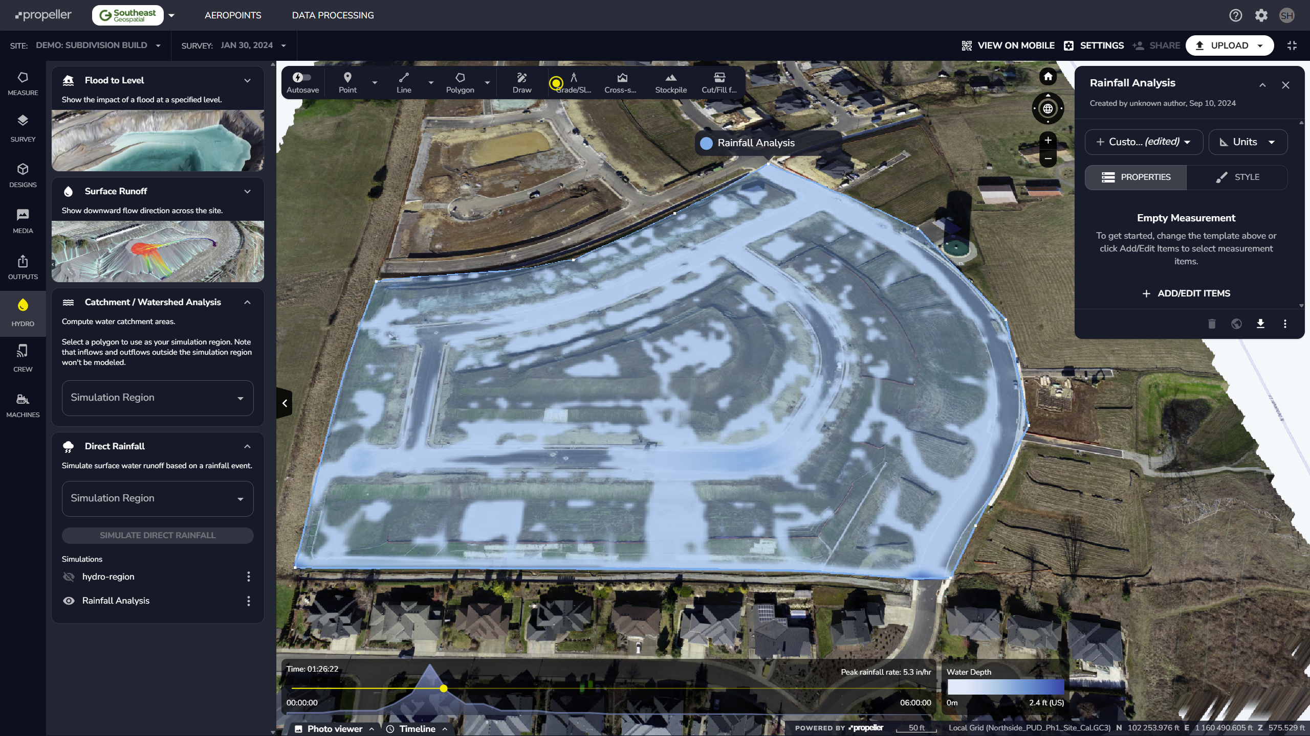
The Hydrology Tools in the Propeller Platform help you understand how water moves and collects on your worksite. These tools are helpful for planning, managing risks, and seeing how your site might react to rain or other water events.
Audit-Ready As-Built Documentation for Every Lot
Your warranty and construction management teams can use our deliverables to:
- Defend against grading- or drainage-related claims
- Provide evidence of proper slope, setbacks, and clearances
- Support third-party inspections with timestamped surface data
- Generate closeout packages for municipalities and HOAs
- Confirm common areas and easements match final plats
We provide timestamped orthomosaics, DTMs, cut/fill comparisons, and as-built contour overlays for every section of your subdivision — all georeferenced and exportable for CAD, GIS, and permitting workflows.
Reduce Risk. Protect Margins.
Post-construction issues like:
- Foundation settling
- Water pooling in yards
- Misaligned driveways or pads
- Blocked drainage easements
…can cost thousands in remediation and hurt customer satisfaction. Verification gives your team a clear line of defense and ensures everyone — from site superintendent to warranty manager — is aligned on what was delivered.
Deliver Subdivisions with Zero Loose Ends
With our drone-powered verification tools, developers can finish with confidence and turn over lots that are ready for occupancy — not liability.
