Streamline Earthwork Operations with Smarter Aerial Insights.
Track Progress. Compare to Design. Eliminate Guesswork.
Traditional earthwork tracking relies on outdated surveys, time-consuming site walks, and assumptions that can lead to costly overruns. Our drone-based data, combined with the Propeller Aero platform, delivers accurate, up-to-date topography weekly or bi-weekly, giving your team the visibility it needs to keep projects moving on time and on budget.
Schedule a demo to see how our platform compares to the competition. We can fly our drone at your location, upload your designs, and show you what our platform can do for you in less than 24 hours. In one demo, we found a $18,000 error in the first 5 minutes – what will we see on your project site?
Regular Flights = Real-Time Earthwork Intelligence
- Areas over- or under-excavated
- Volumes moved since the last flight
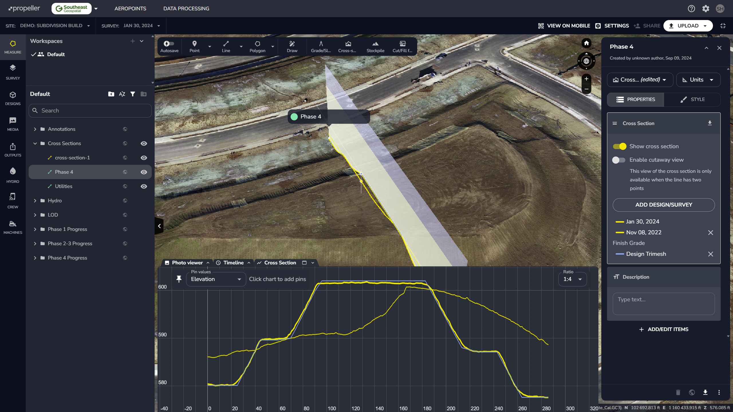
- Cut/fill discrepancies against the design
- Work completed versus pending
Cut/Fill Analysis Without the Wait
- Interactive cut/fill heatmaps
- Volume reports by zone or phase
- 3D design plan overlays
- Export-ready deliverables for Civil 3D or Trimble

Need to verify progress over multiple data sets? Save your measurement as a Site measurement and add the data sets you need to compare.
Benefits That Go Beyond Mapping
- Avoid over-excavation and wasted hauling costs
- Enhance transparency with stakeholders and owners
- Stay compliant with permitting and stormwater plans
- Reduce risk with as-built documentation at every phase
Built for Earthwork-Driven Development
- Bid more confidently
- Build more efficiently
- Finish ahead of schedule
